Nepal - Mardi Himal Trek
I took a ‘career break’ from April 2017 to April 2018, to travel, learn new skills, spend more time in bed and do stuff that I used to do before getting a desk job. This career break started with just under a month in Nepal. This is my account of one of the treks we did called Mardi Himal
Map for reference
Mardi Himal Trek
| Planned duration: | 6 days (16 - 21 April) |
| Actual duration: | 4 days (16 - 19 April) |
Plan Vs Reality
| Plan | |
| Day 1 | Taxi from Pokhara to Kande (2 hours). Walk from Kande (1700 m) to Pitam-Deurali (2100 m) (2.5 hours) |
| Day 2 | Walk Pitam-Deurali (2100 m) to Forest Camp (2550 m) (4 - 5 hours) |
| Day 3 | Walk Forest Camp (2550 m) to Low Camp (2990 m) (3 hours), then Low Camp to High Camp (3580 m) (3 hours) |
| Day 4 | Walk High Camp (3580 m) to Mardi Himal base camp (4500m) and return to High Camp (6 - 7 hours) |
| Day 5 | Walk High Camp (3580 m) to Sidhing (1850 m) (6 hours) |
| Day 6 | Walk Sidhing (1850m) to Lumre (3 hours). Taxi/Jeep from Lumre to Pokhara (3 hours) |
| Reality | |||
| Day | Elevation change | Total times | Details |
| Day 1 | +750m | 6:20 walking. 1:15 driving. |
|
| Day 2 | +1180m | 5:25 walking. |
|
| Day 3 | +800m. -1530m | 5:50 walking. |
|
| Day 4 | -1270m | 2:10 walking. 2-3 hours driving. |
|
Detailed Reality
Day 1: 16 April
08:00 - 09:15 (1 hr 15 min) - Taxi from Pokhara to Kande (2500rs Tourist 6 seater mini van). Organised from our hotel the night before - Hotel Mountain View.
09:15 - 09:30 (15 min) - Ate bananas in Kande. Warded off Tibetan lucky charm sellers. Looked at our map, and realised some of the place names were different, and some didnt exist. ‘Camps’ also weren’t shown on the map. Gave up with map and asked for directions.
09:30 - 10:30 (1 hr) - After being pointed in the right direction down a small stair case, around a building to the left and onto a well trodden path, we set off on our way to Australian Camp. Supposedly an hour and a half away, we took an hour. Lots of stone steps.
 One of the first sign posts we saw on the trek. Sign post quality deteriorated very quickly after this one
10.30 - 11.10 (40 mins) - After a short water and photography break, walked from Australian Camp to Pothana (1890m), the next village along.
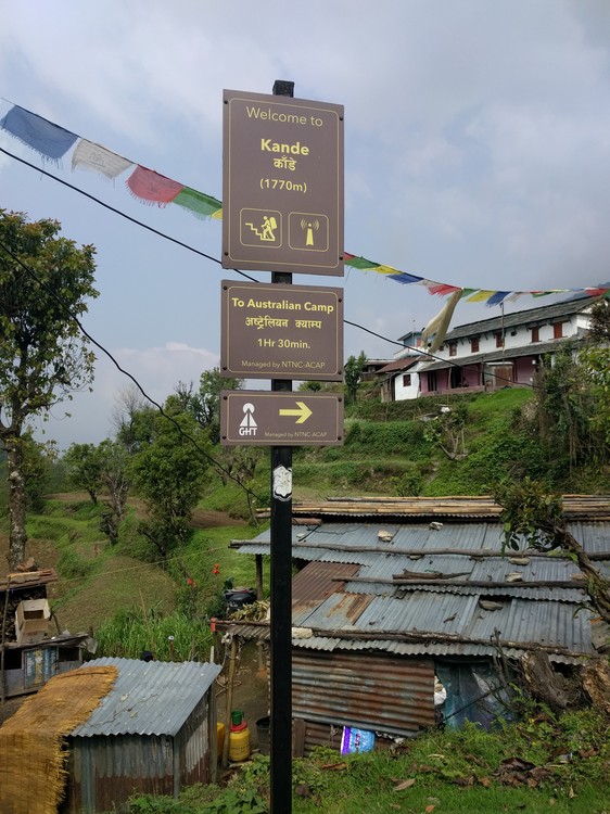
11.10 - 11.30 (20 mins) - Got our Annapurna Conservation Area permits (ACAP) checked at the tourist checkpoint in Pothana. Took photos of the useful sign boards and information they had in the building. One of our group had yet to buy a TIMS card as the tourist office TIMS desk was shut when we went to get it. Luckily he managed to get the ACAP and was told at the tourist office he could get a TIMS card on route. At the checkpoint the man behind the counter only checked out ACAP and didn’t want to see TIMS. When we asked about getting a TIMS card he said they couldnt do it there, and he didn’t think you needed a TIMS for Mardi Himal anyway. So we continued, slightly annoyed that we forked out $20 each for a TIMS we apparently didn’t need. (TIMS cards were never checked throughout the whole trek)
 A useful board showing the expected trek times
11:30 - 12:10 (40 mins) - After buying some snacks and water, we set off to Pitam Deurali which was supposed to be our first sleep stop. However since it was only just past mid-day we decided to get some food and carry onwards. We had our first mountain meal, fried rice, chow mein and dal bhat which would soon become our staple foods.
13:30 - 17:30 (4 hours) - Walked from Pitam Deurali (2100m) to Forest Camp (2520m). Elevation gain of 420m overall. Following our new best friend: the blue and white flag, painted on rocks and trees to mark the way, and the odd sign post giving us confidence we were going in the right direction. This was a beautiful walk through the forest along a very long ridge. Passing a temple along the way offering stunning views.
 This type of sign was relatively common along the way, however the blue and white flag was painted on rocks, trees and the ground even more frequently
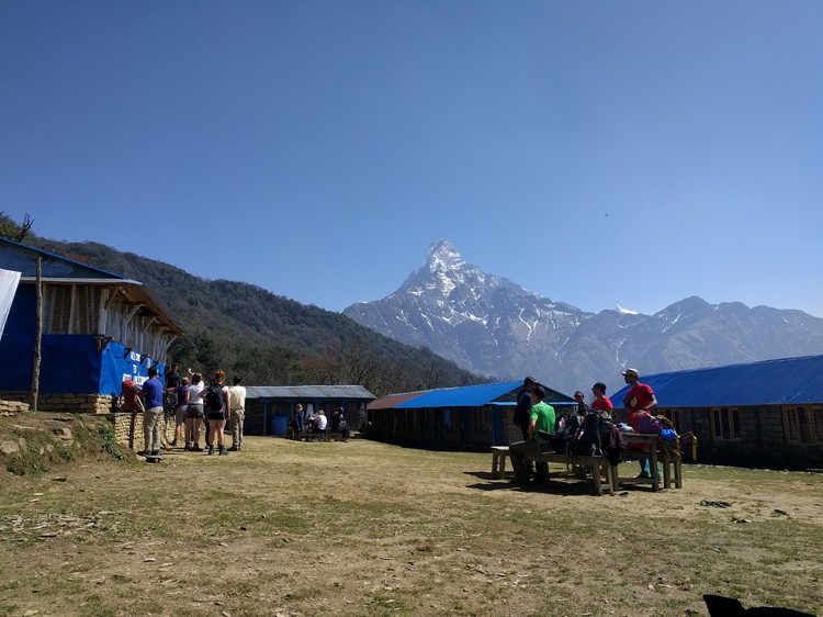
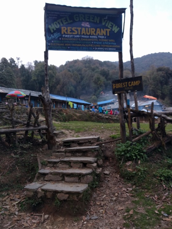 The entrance to forest camp, we were glad to see this, it had been a long day
We arrived at Forest Camp relatively late, being slightly worried that there would be no beds. The woman who served us food at Pitam Deurali recommended the place we stayed at Forest Camp, saying the food is good and room is free if we had dinner and breakfast. She muttered the last part under her breath as if it were top secret. I had heard the same from other travellers we chatted to in Pokhara and Kathmandu, so we assumed this was true and stayed there. Unfortunately the name of the place we stayed escapes me and I didn’t record it, but it was the second place you get to as you enter the forest camp area (it has a fenced perimeter that is closed after dark). As we got there late, all that was left was a single triple room, and there were five of us in the group. We didn’t mind initially as this was our first mountain sleep and we were optimistic and full of energy and excitement. However cramming 5 average to tall guys on 3 small single beds pushed together, ended up with none of us getting much decent sleep. Blankets were supplied but it was warm so I didn’t use one. I used my sleeping bag liner and during the night I pulled my Ethihad airplane blanket onto myself as it was a bit chilly. The others used the blankets and were fine, however only 3 were supplied so 2 of the group had to share.
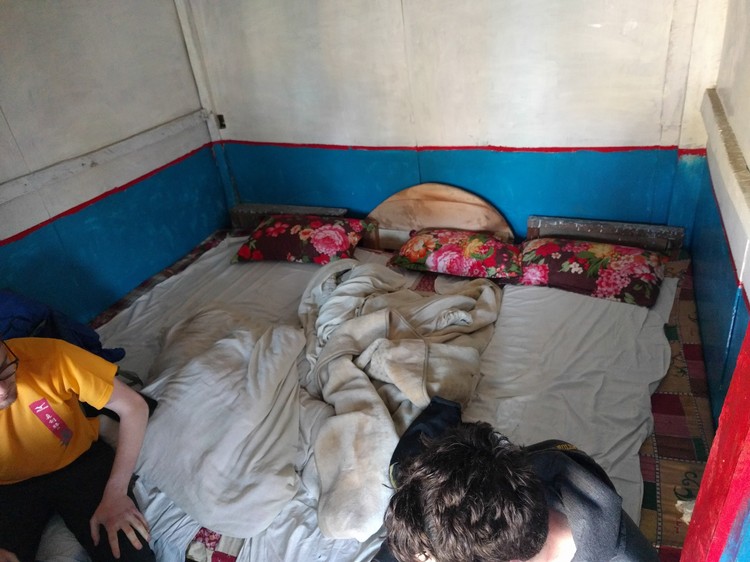 This was our bed for the night. Not quite enough space for the 5 of us.
The food was good, although we didn’t have much choice. There seems to be a standard set menu by the Nepalese government that sets the prices of meals based on the distance from civilisation. Basically this means everything gets more expensive as you go up the mountain, and you’re also not supposed to barter. Also prices are set by the government and changing printed prices by hand is a punishable offence, but we saw this frequently at lots of the tea houses we stayed at. Anyway, this set menu was available and we all decided what we wanted, but the old lady who ran the tea house had other ideas. In broken English and with a huge grin on her face she pointed to each one of us and said ‘Dal Bhat’. So we all looked at each other and came to the conclusion we would be having Dal Bhat that evening. After some time food arrived and it was good. A large plate of plain white rice served with a small dish of Dal. I just poured the Dal onto the rice and wolfed it down. Dal Bhat is commonly unlimited, and once your plate is nearly empty, the host will offer you more Dal and more rice if you so wish to take it. I often had two to three helpings, it’s amazing how hungry hiking makes you. Other meals such as fried rice, chow mein and momos don’t offer this.
It was a good thing Dal Bhat was unlimited, as Dan tried to lightly salt his meal, and in doing so managed to tip the entire contents of the salt shaker onto his plate when the lid came off. After the laughter died down, and the majority of the salt had been scraped off the surface, the meal was still too salty to handle. Dan decided to ‘dilute’ the salty mess on his plate with a second helping of dal and rice. This worked to a certain extent, but he still ate that meal with a grimace on his face.
We awoke the next morning just before 6, as we had ordered our breakfast the previous night for that time. 3 Tibetan bread, one Chapatti and one bowl of museli. The bread stuff was a help yourself to honey, and jam type affair. The museli came with warm fresh milk from what we assume was either a cow, buffalo or yak. I was a little concerned about drinking milk as it’s straight from the animal with no pasteurising but I think heating it goes some way to kill nasties? Need to check up on this. Nothing bad happened to my stomach anyway, and it was a good breakfast. The others Tibetan bread looked good but not as substantial as my museli. I think I made the right choice.
 The view in the morning
When it came to paying, we totalled up the food (3425rs) and then noticed the standard room charge pricings on the menu. This contradicted with what the woman in Pitam Deurali had told us. I asked the woman whether the room was free because we had breakfast and dinner, and was met with a huge laugh, a slap on the back (friendly) and the phrase ‘hahaha it’s not free, it’s not free’. So we stuck an extra 415 rs on the bill, payed up and left.
 The beds weren’t free
Day 2: 17 April
07:30 - 09:30 (2 hours) - Walked from Forest Camp to Low Camp via Rest Camp (08:00). This is where we got our first proper glimpse of the snow covered mountains. We took a break and had some food and tea at a very friendly tea house at the top of low camp. They were in the process of building a middle tea house and Hotel Machapachure was at the bottom of the perimeter. The man at Hotel Laligurans, which is the teahouse at the top of Low Camp, showed us a proper map, which I took a picture of for future reference (which was our most useful map for the entre journey). He gave us lots of useful advice and was always smiling.
 The view from Low Camp, and our first proper glimpse of the mountains ahead.
11:45 - 13:20 (1 hr 45 min) - Walked from Low Camp (2970m) to Mid Camp. Mid Camp is a small camp with two tea houses, where we only stopped for water and picture taking.
13:30 - 15:10 ( 1 hr 40 min) - Walked from Mid Camp to High Camp. High camp would be the highest sleep on the trek at 3700m. It was noticeably colder at this altitude, and we had all been noticing a shortness of breath when climbing up wards, however interestingly it didn’t take long at all after stopping for breathing to return to normal. Walking down hill was comparatively easy, with little to no shortness of breath.
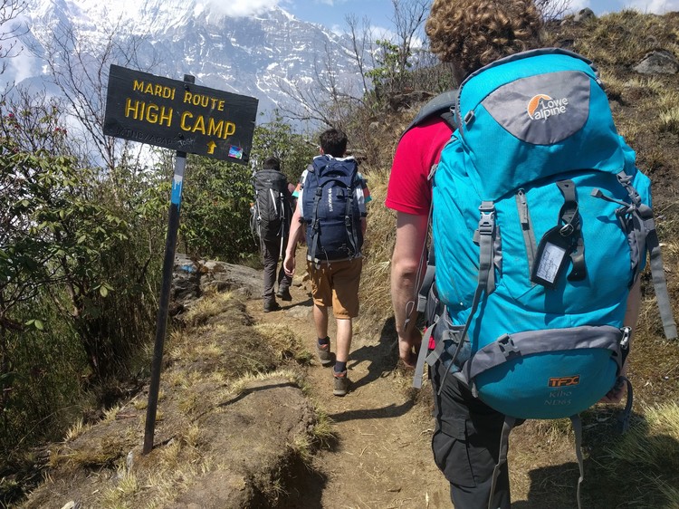 Walking to High Camp
High Camp is also where I experienced my first ‘Mars Roll’ which is a Snickers bar wrapped in some sort of bread like pastry and shaped like a Cornish pasty. It came with custard on top and was absolutely amazing. Considering I hadn’t had anything sweet since I got to Nepal, this really hit the spot. We called these Mars Rolls ironically because I asked for a mars roll and it turned out to be a snickers, and the second time I got one the same happened. So we joked that I should buy a mars bar and ask them to make one with an actual mars bar. Sadly the only place I found above high camp that sold mars bars would be the next day at View Point, where the price made me cringe. Also Hotel Machapachure at Low Camp where we would stay the next day didn’t have Mars Roll on the menu. It was a short but sweet affair.
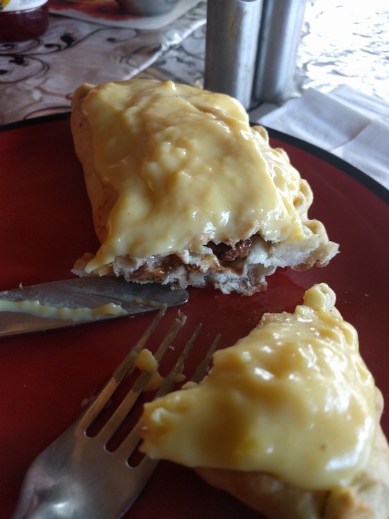 The legend-dairy Mars roll
The food here was good too, despite another mishap with condiments. As you know the previous day, Dan had over-salted his meal when the salt shaker lid fell off. Well now it was Toms turn. Tom likes chili sauce, and wanted to add some to his plate of Dal Bhat. When he tipped the bottle over his food, the lid came off and the entire contents of the bottle was emptied onto his plate. That was one spicy meal. From that point on, none of us trusted anything with a lid.
We explored High Camp where the view was an improvement on the already amazing views of Low Camp. We went exploring as the sun was setting and there was a lake of cloud below us. We took some photos of both the beautiful scenery and our bad outfit choices and then went to bed.
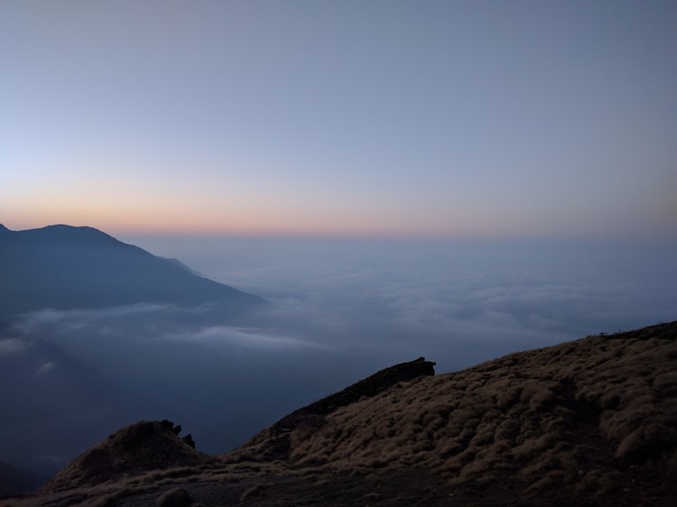 Cloud lake, just one of the stunning views
I awoke the next day unusually early at 5.15 and went out to the toilet. It was just getting light and the stars and the moon were on show. The sky looked beautiful so I grabbed my photographer roommate and we wandered around taking photos until breakfast time at 06:00.
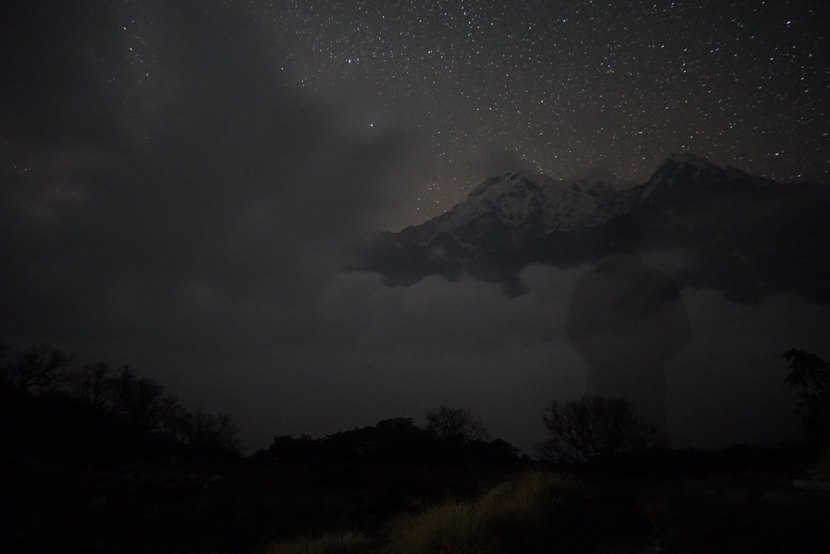 Early morning stars. Credit @mr_daniel_longley
Day 3: 18 April
07:30 - 08:40 - Walked from High Camp (3700m) to View Point (4300m). We set off for Mardi Himal Basecamp at around 7.30 after a fair amount of faffing. We decided to leave our heavy bags at High Camp as we would be returning back after visiting Base Camp and there was no point carrying a load of dirty washing and sleeping stuff up to the top. This was a welcome treat after 2 long days of trekking with full weight sacks. It was also a good thing as there were some seriously steep sections, where using your hands to scramble up the rocky path was nessecary. There were some scary cliff-like drops and hills that if you started rolling down, you wouldn’t stop until you got to the bottom of the mountain.
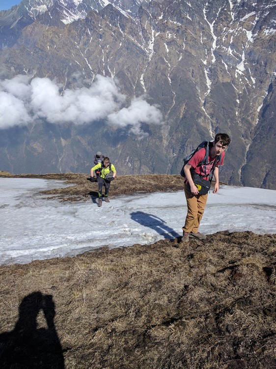 Proper mountaineering
08:45 - 10:00 (1 hr 15 min) - Walked from View Point (4300m) to Mardi Himal Base Camp (4500m) which was the top of the trek. This was an exciting but tiring journey with some snowy ice patches to make things even more interesting. There were multiple view points along the way, marked by flag poles and stone platforms.
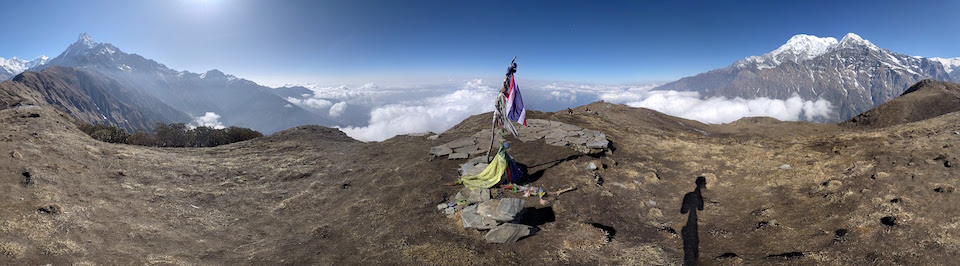 Panorama from one of the many view points along the last stretch
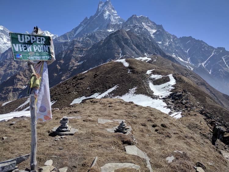 Arriving at Upper View Point
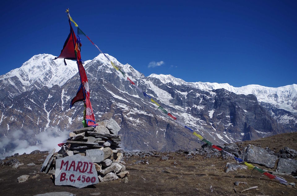
Despite the snow, we trekked up in tshirts as it was still hot from the blinding sun. Factor 50 at the ready was a must. We found base camp from the Nepalese flag and stone with ‘Mardi B.C. 4500’ written on it. There was also a stone with ‘Vegan <3’ etched into it - clearly some enthusiastic vegans had been here previously. We took some photos, selfies, had a lye down and ate some snacks whilst taking in the amazing views.
 Arriving at the top, Mardi Himal Base Camp. Credit @tom.sinclair
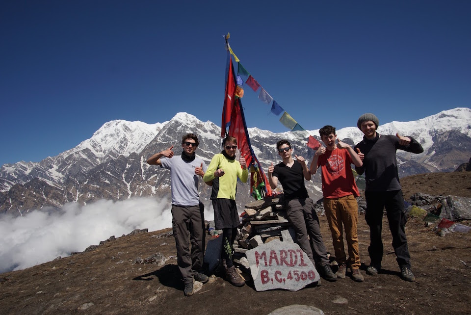 Group photo at the top of Mardi Himal Base Camp. Credit @mr_daniel_longley
10:45 - 11:30 (45 mins) - Walked down from the Mardi Himal Base Camp to View Point. Cloud rose quickly as we descended and if we had got to Base Camp any later, we wouldn’t have had any view of anything. We were lucky that we sped up the journey. By the time we reached View Point, we were inside a thick cloud.
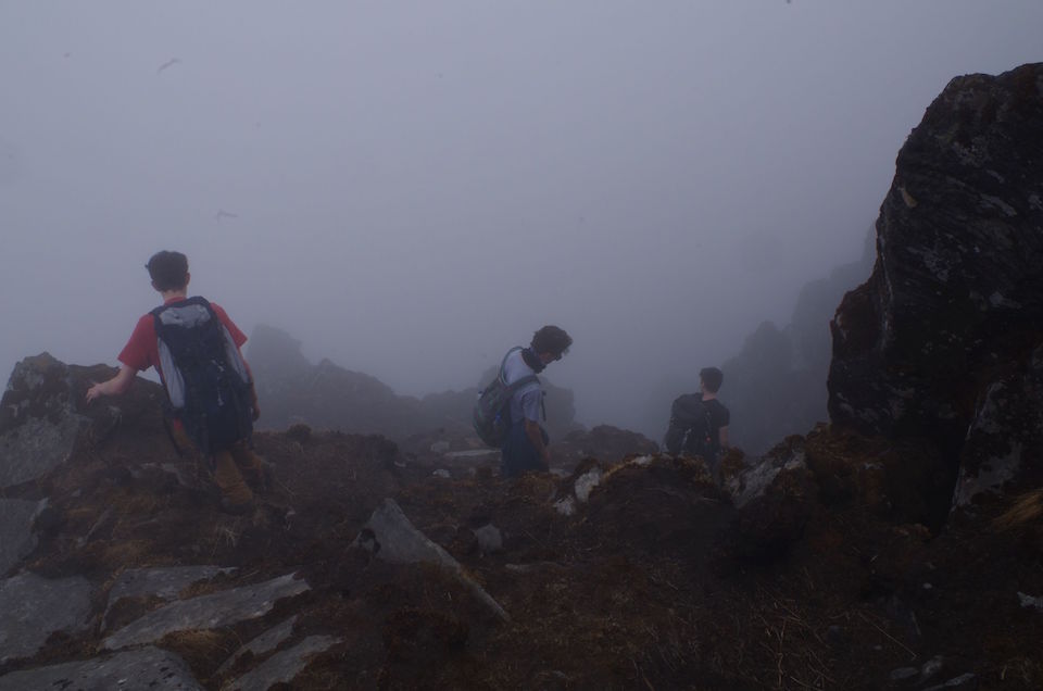 Descending into a thick cloud on the way down from Mardi Himal Base Camp. Credit @tom.sinclair
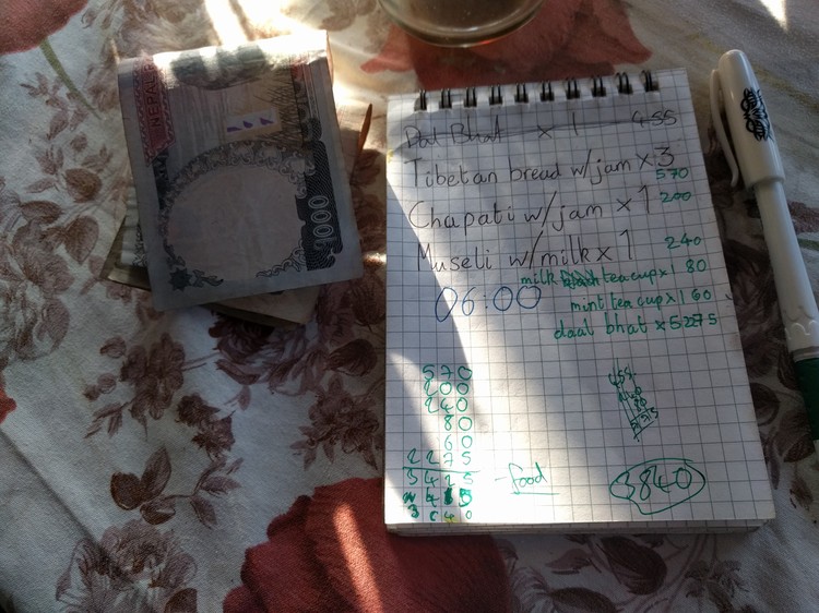
11:30 - 12:50 (1 hour 20 mins) - We descended from View Point down to High Camp. However due to the misty cloud, visibility was around 10-20 meters. We took a wrong turn at a steep junction and ended up scrambling along a precarious slope, with lethal looking drops to our left. We clearly weren’t on the path, and I was fearing the worst so I asked the group to turn around, find the path and wait it out a while until either the visibility improved or people came along who knew the path. We couldn’t even remember where we had come from, so more precarious scrambling one at a time, very slowly and cautiously we climbed back up the slope to the big rock with the blue and white flag on it. Safe in the knowledge we were on the path, we rested and drank while we re thought the situation. Luckily, after around 5 minutes, an American family caught up with us, and they had two porters and a guide. So we followed them for a while until the path was clear enough for us to continue alone. The visibility was constantly bad and we had to stay close so that we could see the next member along. Eventually High Camp emerged out of the mist and we were greeted with food and tea. I had a Mars (Snickers) Roll to celebrate being alive still. We settled the bill (over 10,000 rs) and headed on down the mountain.
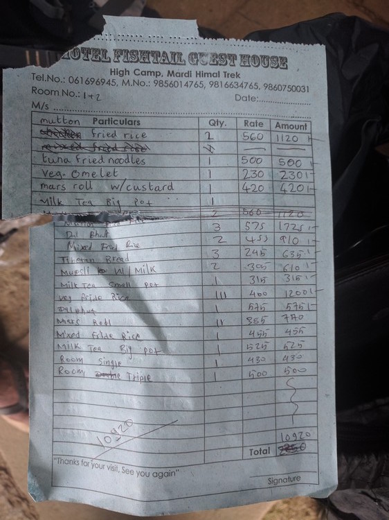 High camp bill
14:40 - 15:30 (50 mins) - Walked from High Camp to Mid Camp. Short DEET (insect repellant) and water break, not much point in photography due to poor visibility.
15:30 - 16:00 (30 mins) - Walked from Mid Camp to Low Camp. We would sleep here for the night. At High Camp, the cook of Hotel Fishtail called down to his brother at Hotel Machapachure at Low Camp to book a couple of rooms for us as it was apparently very busy. I thought that Hotel Machapachure was the nice smiley man’s teahouse (which turned out to be Hotel Laligurans), so I was happy with that. However when we arrived and said we were staying at Hotel Machapachure he looked dissapointed and pointed us towards the lower teahouse. I felt a bit guilty because he had been to helpful to us, but we did buy food and tea from him, so it wasn’t all bad. We made our way to Hotel Machapachure and spoke to the owner, who after some confusion gave us three double rooms for the price of a double and a triple. Clearly something got lost in translation. We put our stuff away, and some of the group went to sit in the communal dining area that all teahouses have. A few minutes into cleaning my soaking wet, wrinkly feet, a member of our group suggested trying to get a room at nice smiley man’s teahouse because there were lots of people in bed sleeping in the communal area and we didn’t want to disturb them. Also it would be nice to speak to smiley man again and ask his advice on some things, as the owner of Hotel Machapachure wasn’t very talkative or helpful, or even around. Smiley man had rooms available but wanted us to speak to Machapachue man before moving to check its ok. I did that, and at first he said no problem, move if we like. So I went to get my things. However a few seconds later he came back complaining that it was not a good move as we had rung ahead to book the rooms and he had turned customers away as we had reserved the rooms. Fair enough, we apologised and said we would stay here. He also mentioned that we should use the communal area as we wanted, and if anyone complained they should go to sleep in their own rooms and he would deal with it. Awkward drama over, we went to get some food - which wasn’t amazing, but maybe that’s because we ordered a pizza. The pizza was not good. The curry and rice dishes were fine though.
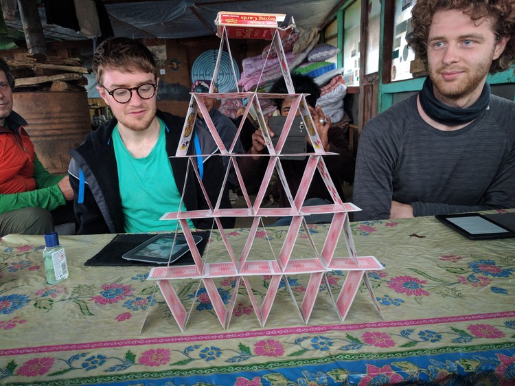 Things to do in the evenings - build a house of cards. The locals were amazed - can you see the guy taking a photo in the background?
We awoke at the usual time of 6am, had breakfast and packed up.
Day 4: 19 April
07:30 - 09:40 (2 hours 10 minutes) - Walked from Low Camp (2970m) down to Sidhing (1700m) which is down 1270m. By this time the path was very muddy due to light rain and wet conditions. We took things slow and there was only one minor slip in the mud with no injuries. At Sidhing, the weather was still rubbish and the group didn’t seem to be enjoying the conditions. The wife of the owner of Hotel Lalingurans had a lodge in Sidhing called Guatam Cottage. It’s on the left of the fancy looking hotel as you pass the buffalo sign. They have jeep facilities and the general group feeling was that we should get a jeep back to Pokhara. We had tea with the owner and waited it out as the heavens opened. We were glad we decided to get the jeep down because the rain was so heavy, there were rivers forming on the hills. Eventually the jeep got there, and after helping the two young guys unload some bags of cement we headed down the mountain.
The jeep ride from Sidhing to Pokhara was an exciting and scary experience. The road was rocky, narrow, and deadly drops were common. The rain didn’t help, neither did the steamy windows. After driving through winding mountain tracks, rivers and small towns, we arrived at Hotel Mountain View after approx 2-3 hours.
Altitudes
These sometimes differ between the photo of the map I took from smiley man, and the photo of the sign I took at the Pothana Tourist Checkpoint.
- Kande 1770 (map)
- Pothana 1950 (sign), 1890 (map)
- Pitam Deurali 2100 (sign and map)
- Forest camp 2420 (sign), 2520 (map)
- Low camp 2995 (sign), 2970 (map)
- High camp 3550 (sign), 3700 (map)
- View Point 4300 (map)
- Mardi Himal BC West 4500 (sign and map)
Suggested times
These are from the sign board at Pothana Tourist Checkpoint.
Up:
- Pothana - Pitam Deurali 0:45
- Pitam Deurali - Forest Camp 4:30
- Forest Camp - Low Camp 2:00
- Low Camp - High Camp 3:00
- High Camp - View Point 2:45
- View Point - Base Camp 3:00
Down:
- Base Camp - View Point 2:00
- View Point - High Camp 1:45
- High Camp - Low Camp 2:00
- Low Camp - Sidhing 3:30